Perth Airport (PER)
City Orientation and Maps
(Perth, Western Australia (WA), Australia)
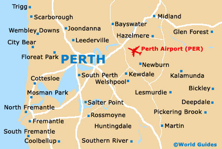
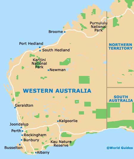
The city of Perth lies on the south-western coast of Australia, alongside the Indian Ocean, next to Fremantle and east of Rottnest Island. Located in the state of Western Australia (WA), Perth Airport (PER) can be found to the west of the city centre.
Perth is situated close to a number of noteworthy towns, such as Sorrento to the north-west, Joondalup, Warwick and Mirrabooka to the north, Redcliff to the east, and both Mount Nasura and Armadale to the south. Also nearby, Rockingham and Safety Bay are located to the south-west of Perth and can be reached along the Kwinana Freeway, which is intersected by many major roads, such as Canning Highway and Leach Highway.
Perth Airport (PER) Maps: Important City Districts
The city centre is fairly compact and lies next to the Swan River, with scenic waterfront areas located on both the eastern and southern sides. Much of the main action in Perth is located around Murray Street and Hay Street, where you will find two of the city's largest shopping malls.
The main areas of finance and commerce in central Perth are sited along St. George's Terrace, while the western side is dominated by Kings Park, which is known for its river views. Over the main railway line and to the north of central Perth, the Northbridge neighbourhood is where the true heart of the action can be found, being full of dining venues, cheap hotels and a host of entertainment options. Further districts in Perth include Highgate, Leederville and Subiaco, while those looking for water sports and beaches should head to the north-west, where the stretches of coastline around Cottesloe and Scarborough are well worth visiting.
Australia Map

Western Australia Map
Perth Map